Sixth Day
This morning we did not have to wait on anybody, not even Cody. After the greatest breakfast at Norbert's We were getting ready to go to the Grossglockner, and climb the glacier.
Großglockner-Hochalpenstraße
www.mapblast.com
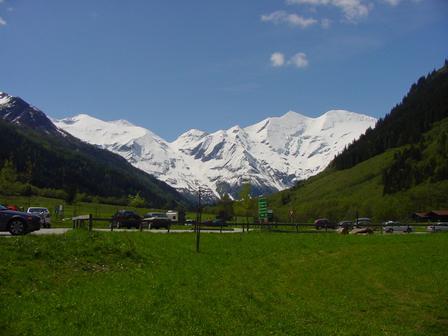
We drove on the very beautiful Großglockner-Hochalpenstraße.
Entrance station to the Großglockner-Hochalpenstraße
The Großglockner-Hochalpenstraße, also
known as the Großglocknerstraße, is an alpine toll-road that bisects the
Austrian Nationalpark Hohe Tauern from north to south. The road was constructed
from 1930-1935 as part of an economic stimulus package to combat the effects of
the world-wide recession. During those five summers, 3000 workers labored to
accomplish the unprecedented task of laying over 40 km of road with, more than 6
km of those at altitudes over 2200 m.
In many places, the Großglocknerstraße follows the ancient trading routes that
used to connect the Roman settlement of Aguntum (near Lienz) to points north of
the Alps. During the Middle Ages, segments today occupied by the
Großglockner-Hochalpenstraße served as mule paths used to exchange Venetian
cloths, wine, glassware, and spices for gold, silver, and salt mined in areas
north of the Alps. In 1971, the Austrian provinces of Kärnten, of Tirol, and of
Salzburg, entered in agreement for the foundation of the Nationalpark Hohe
Tauern, which with its 1800 sq. km, is the largest national park in the Alps
today. Every year, from mid-May to early November, the
Großglockner-Hochalpenstraße enables 1.2 million visitors to enjoy the splendor
of this national park from the comfort of their car seats. No visit to the
Austrian Alps would be complete without a drive through it.
(http://users.erols.com/espina/Climbing/Austria9708/Grossglockner/)
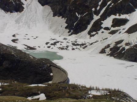
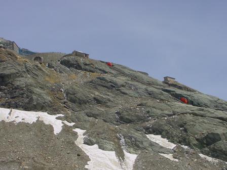
Dam close to Kaiser-Franz-Josefs-Höhe
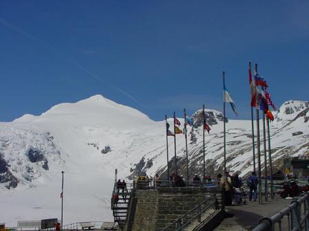
The end of our driving this
morning was the Kaiser-Franz-Josefs-Höhe, 2369 m.
Here we found a large multi-level
parking garage, gift shops, a restaurant, and an observation
deck on which we were amazed by the view of Großglockner (3798 m), the
tallest mountain in Austria, and the Pasterzenkees, the longest glacier
in eastern Europe. It is 10 km long, 300 m deep, and has a surface
area of 20 km2. In recent years it has receded over 50
m.
From the Kaiser-Franz-Josefs-Höhe, the Pasterzenkees can be accessed by a class 1 trail (i.e., loose footing) or via a funicular rail which descends 143 m. When this rail was constructed decades ago, it used to reach the surface of the glacier. Today, the ice has receded so much that the rail only reaches the half way point between the Kaiser-Franz-Josefs-Höhe and the Pasterzenkees (http://users.erols.com/espina/Climbing/Austria9708/Grossglockner/).
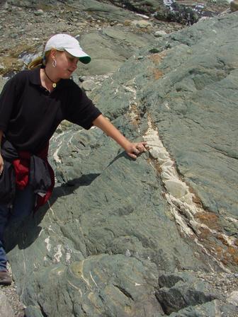
We had a great time hiking to the glacier, and coming back up. The elevation difference was about 2000 feet, the environment was great.
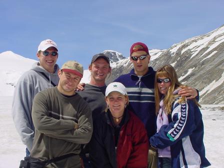
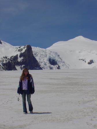
We are on the glacier
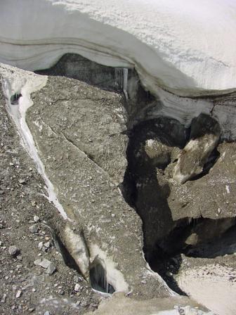
Crevasse near the end of the glacier
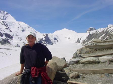
On the way up
After our tour, we bought our gifts in the gift shop, and started our journey to Italy. At the border we did not get a stamp again. Hurrah we were in Italy.
Italy, Lake Misurina
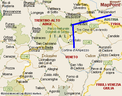
(http://www.mapblast.com/(in50rw55fuyvaguys3tcgf45)/Home.aspx)
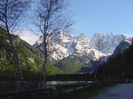
On the way to Misurina
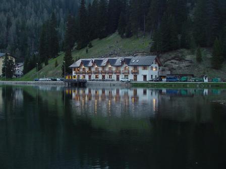
We arrived to Lake Misurina around 4 p.m. We all fell in love with the lake in a minute or so...Especially after we learned about our motel. Anna found this very beautiful motel on the lake with unbelievable views and fantastic rooms.
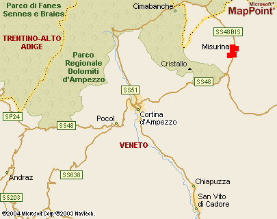
Surrounded by the beautiful peaks of Lavaredo situated along the shores of the picturesque lake Misurina it is not a surprise that Italians call this place “the pearl of the Dolomites”. We could not stop admiring the Three Peaks and the surrounding mountains such as Cristallo, Sorapis and Cadini. From the numerous U shaped valleys it was obvious that During the peak of the last glacial period, about 20,000 years ago, this area must have been covered with glaciers. When the glaciers subsided (about 17,000 years ago), materials piled up on their fronts. We learned that lake Misurina is the biggest natural lake in Cadore.
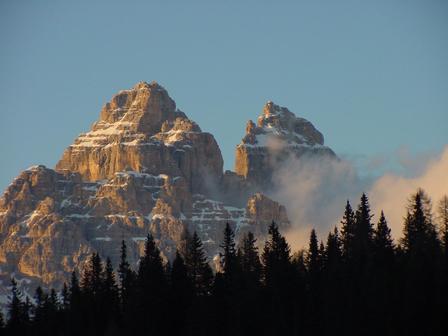
The Three peaks and the lake
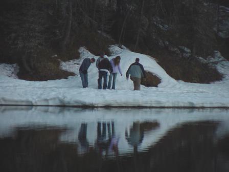
Playing in the snow
Our Hotel, with our balconies
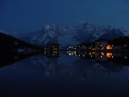
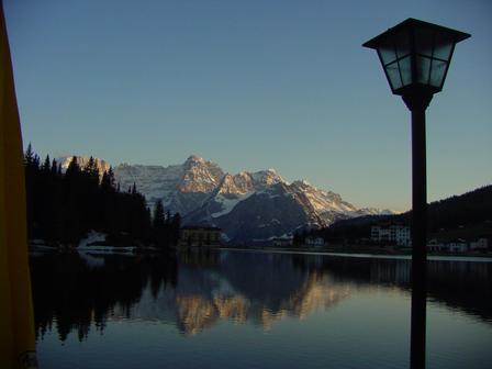
The lake at night
![]()
![]()
(In this section, if otherwise not stated, the pictures were taken by, and the property of Dr. Anna Balog-Szabo)