Third Day
(05/19/2005)
We had to get up at 8 a.m. It was far tooooo early after the big party we had, but we had to do it. The breakfast was very good, and our hosts were exceptionally kind. They almost packed us lunch for the road. The weather was ghastly. Lots of rain, and hard wind. First we wanted to climb up to a medival castle Sumeg, close to Tapolca. However the rain and the wind were really bad, so we ended up just taking a picture.
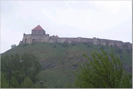
(Lonely Planet) Sumeg castle
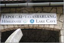
We had to come up with some inside activity, so Dr. Anna took us to an underground adventure. We visited the lake cave in Tapolca.
Pond Cave in Tapolca
“The pond Cave in Tapolca was first discovered in 1902. Pál Tóth baker buckled down to build his house and started to dig a well with Ferenc Németh bricklayer. They started the job in January 1902 going downwards at first with pickaxe, but later managed to proceed in the rock with explosions only. First they found a small cave, but after continuing the digging one of the nook fell in and gave way to a yawning creep in the dark.
The Pond Cave has been formed in the horizontally stratified Miocene (Sarmatian) limestone. At the end of the Tertiary era the area between Vienna-basin and Lake Aral was covered by epiric sea water. The coarse grained limestone, containing plenty of fossils, formed in this sea.
The pleasant, warm and humid air in the caverns is very unique and has a beneficial effect on people suffering from asthmatic and respiratory diseases.” (http://www.bauxit.hu/tbarlang/gbbarlang/index.htm)
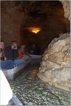
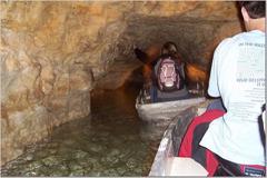
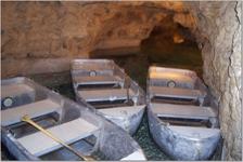
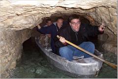
Our cave pictures
After Tapolca, the rain stopped so we went to the Hegyestu geological study trail.
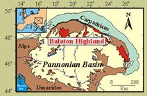
“In the Carpathian-Pannonian Region alkali basalt volcanism followed the Miocene-Pliocene subduction-related calc-alkaline magmatism. Among the Late Miocene-Pleistocene alkali basalt volcanic fields within the CPR, the Bakony-Balaton Highland Volcanic Field is the largest and best-studied area. The volcanic activity which lasted from 7.5 to 2.8 Ma produced lava flows and pyroclasts.
The Hegyestu area is a remnant of a lava neck (volcanic channel) showing beautiful example of columnar jointed basaltic rocks.” (http://ecrofi17.geology.elte.hu/trip2.htm#balaton)
The Hegyestu area is an abandoned basalt quarry, which has been transformed into a geology educational path. In the middle of the quarry a little geological garden informs the visitors about the geology of the area.
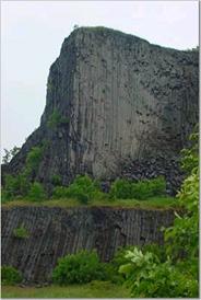
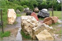
Hegyestu
After the Hegyestu visit, we have tasted the universal Hungarian “hot” drink in cold weather the so called boiled vine. Dr. Anna said it was not as good as if she had made it.
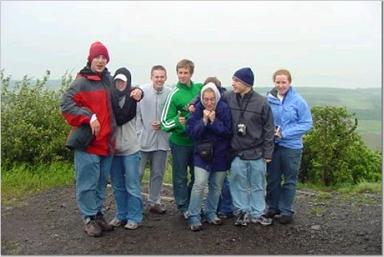
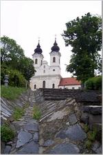
Our next stop was Tihany. The weather still was not very good, so we had a really good lunch in a nice restaurant. After that we climbed up to the famous look out of Tihany.
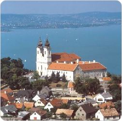
This is how it is in nice weather
(http://www.ecm22.mtesz.hu/pimages/Tihany.jpg)
After Tihany we started our way toward Budapest.
By the time we got there the blue sky started to show, so we decided to start our
Discovery of the city.
“Who has ever been able to explain where love comes from? What is it that makes two people feel attracted to each other? It is a complex of physiological and psychological processes, inexplicably beautiful, uplifting and down-to-earth. It is much the same with cities, though their allure is easier to explain. We take away with us the abiding impressions of buildings, streets, squares and sights, and of course, the atmosphere, the feel of the place. That is the sort of magnetic quality that Budapest radiates. Peaceful and bustling, a big metropolis and yet friendly, it treasures the old and embraces the new. Here the historic blends with the modern, the hills harmonize with the river, that is, the Danube, which flows through the city along a stretch of 28 kilometres.” (http://www.fsz.bme.hu/hungary/budapest/budapest.html)
Budapest:
“There is more to Budapest than fish soup, paprika and Zsa Zsa Gabor. With its multifarious and often embittered history, incredible architecture and rich cultural heritage, Hungary's capital has the justly deserved sobriquet of `the Paris of Central Europe', set apart from other Hungarian and European cities by its beauty. The city straddles a gentle curve in the mighty Danube River, the Buda hills rising dramatically on the west bank while the Pest district marks the start of the Great Plain to the east. The largest Hungarian city by a mile, Budapest is the heart, soul and memory of Hungary, with the Danube coursing through its veins. The city has a complex identity, currently facing something of a crisis with the allure of modern Western luxury in conflict with the simple traditions of its Eastern European roots and penchant for all things classical. The focal point of Budapest is the Danube River, which bisects the city into two distinct parts: Buda is mostly residential and built on the hills and high river terraces of the western side, and commercial Pest is on a large, sandy plain across to the east.” (http://www.lonelyplanet.com/destinations/europe/budapest/)
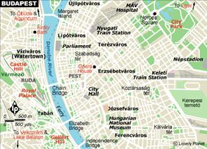
(Lonely Planet)
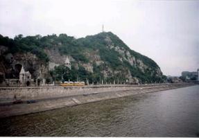
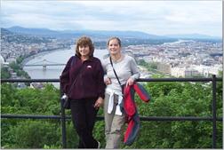
First we parked close to the Hotel Gellert, and walked up to the top pf the Gellert hill.
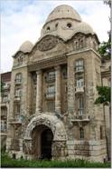 Hotel
gellert
Hotel
gellert
Gellert Hill from the Danube (http://www.wordsareimportant.com/photos/hun9.JPG)
From the Danube the Gellert hill seems much taller than it is. The top of the hill is only 140 meters (430 ft.) above the river. Owing to its exceptional situation, it offers a priceless panorama of the entire city. The Citadel, the fortress on top of the hill, was built between 1850 and 1854 by the Habsburg authorities to control the city after the suppression of the Hungarian War of Independence. In 1897 the Austrian troops left the fortress, and in 1899 the city of Budapest, which bought it, had the walls symbolically demolished -as can still be seen next to the main gate-but. During WWII it was from the Citadel that the encircled German troops kept the city under gunfire until their final surrender. Today the Citadel serves as a look-out terrace. The former barracks have been converted into a tourist hostel.
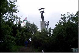
The Liberation Monument (the work of Zsigmond Kisfaludi Strobl) was erected in 1947 to commemorate the liberation of the country and in honor of the soldiers of the liberating Soviet Army ( today we call it occupation ).
Geology:
The Gellert Hill as a unit belongs to the Buda mountain. The hill itself is 235 m high dolomite cliff. At the foot of the hill there is a major fault line, along which the hanging wall dropped about 1 1000m. Along the fault hundreds of thermal springs can be found which made Budapest a very famous spa city.
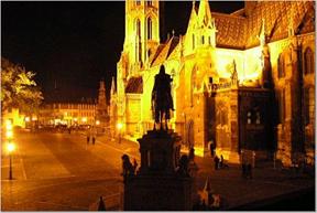
After the Gellert Hill the weather was beautiful the lights of Budapest were on. Everything was so beautiful so we decided to visit the castle hill.
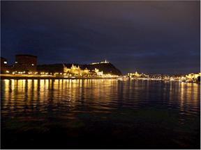
Budapest at night
“Castle Hill is the premier destination for visitors and contains many of Budapest's most important monuments and museums, and grand views of Pest across the snaking Danube. The walled area consists of two distinct parts: the Old Town where commoners lived in the Middle Ages, and the Royal Palace.” (http://www.lonelyplanet.com/destinations/europe/budapest/)
After all this we were ready to go to see some more beautiful places such as the hero square.
“The hero square has the nation's most solemn monument - an empty coffin representing one of the unknown insurgents from the 1956 Uprising - beneath a stone tile. The inspirational Millenary Monument, a 36m (120ft) pillar backed by colonnades. To the north of the square is the Museum of Fine Arts, which houses the city's outstanding foreign works (especially the Old Masters collection), while to the south is the ornate Palace of Art.” (http://www.lonelyplanet.com/destinations/europe/budapest/)
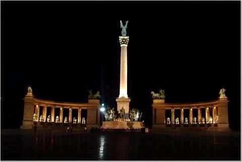
Hero square at night
![]()
![]()