![]() At
the end of the last glaciation (Würm), the oversteepened and
almost vegetation-free slopes led to widespread mass
movements. Besides till and fluvioglacial sediments, the
valleys are therefore characterized by rockfalls and debris
cones. The largest rockfalls occurred in the limestone
areas, such as the Flimser Rockfall in Switzerland, which is
the largest one in the Alps (12 km3;). Up to now,
the Rhine River has cut a 600-m-deep canyon into these
probably late-glacial deposits. In the crystalline areas,
rockfalls are smaller, the largest being the Early Holocene
Köfels Rockfall in Austria (2 km3). Many
rockfalls initiated debris flow and catastrophic floods.
From:(http://www.bioone.org/bioone/?request=get-document&issn=0276-4741&volume=021&issue=04&page=0340#s2)
At
the end of the last glaciation (Würm), the oversteepened and
almost vegetation-free slopes led to widespread mass
movements. Besides till and fluvioglacial sediments, the
valleys are therefore characterized by rockfalls and debris
cones. The largest rockfalls occurred in the limestone
areas, such as the Flimser Rockfall in Switzerland, which is
the largest one in the Alps (12 km3;). Up to now,
the Rhine River has cut a 600-m-deep canyon into these
probably late-glacial deposits. In the crystalline areas,
rockfalls are smaller, the largest being the Early Holocene
Köfels Rockfall in Austria (2 km3). Many
rockfalls initiated debris flow and catastrophic floods.
From:(http://www.bioone.org/bioone/?request=get-document&issn=0276-4741&volume=021&issue=04&page=0340#s2)
Twelfth
Day
(05/26/2005
This morning we really had to get up early. We new we had an extremely long day ahead of us. We wanted to climb the glacier at the highest peak in Austria. Also we had to go all the way to the Netherlands. Early in the morning we tried to get some money, because most of the banks are closed on Sundays and we needed some euros. Also bought some food at a grocery store.
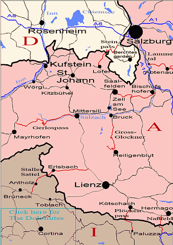
(www.alpineroads.com/ salzburg.php)
Our drive to the Grossglockner was not too long. Soon we were in the grandiose mountain on the way to highest peak of Austria.
This is what we saw on the
way:
 184 of them.
![]()
At 3,798m the Grossglockner is not only the highest mountain in
Austria, it also counts among the highest peaks in the Alps.The
mountains have always been considered dangerous by people. Difficult
weather conditions and the lack of surfaced trails made a crossing
unthinkable. Nevertheless, there are ancient traces that prove the
daring spirit of the people. Such finds as pre-Celtic bronze knives,
Celtic gold jewellery, a Roman Hercules statue, medieval pack-animal
bridles and the chains of galley slaves from the 17th century are
witness to the crossing of the Hochkar almost 4,000 years ago. Until the
highpoint of trade in the 17th century, after the Brenner and the
Radstadt Tauern, the Hochtor was the third most important trade route
carrying almost ten per cent of the trade goods over the eastern Alps.
However, not only danger was found in the mountains, but also
fascination. The first ascent of Mont Blanc was a tremendous sensation
and also brought forth brave men here at home. But only the second
Glockner expedition in 1800 led to success. Victory and failure also
accompanied other expeditions. The Pallavicini Gully was named after
Margrave Alfred Pallavicini, who died on the Glockner in 1886.
With the building of the Grossglockner High Alpine Road, the majestic
peak acquired a new dimension. As a popular excursion destination it is
the epitome of an impressive natural experience for many people: size
and power can be felt here, one is subject to the fascination of the
eternal ice and the elemental force of nature(http://www.grossglockner.com/grossglockner/).
As we were driving up on the "Grossglockner Hochalpenstrasse", we were more and more astounded by the beauty of the Alps. The splendid view we have just heard about before. After parking we started our descent to the glacier. For most of us this was the very first time to actually walk on a glacier.
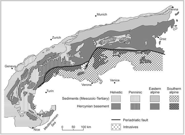
"The Alps consist of parts of the European Plate, a former Jurassic to Lower Cretaceous ocean floor, and the Adria Plate as part of the African Plate. A complicated pattern of overthrusted nappes characterizes the tectonic style. As a general rule, tectonically higher nappes originate further south. If the pile of nappes were hypothetically rolled out, the result would be 4 main former facial areas—the Helvetic, Penninic, Eastern, and Southern Alpine Additionally, there are the autochthonous to parautochthonous, prealpidic crystalline Helvetic central massifs. Reconstruction of the tectonic evolution resulted in a compression of the former ocean (Tethys) in the order of 500–800 km or even more . During the collision of the African Plate with the European continent, the western Alps were more heavily compressed than the eastern Alps. This had several consequences: The eastern Alps have the greatest diameter, whereas the highest peaks occur in the western Alps. Eastern Alpine nappes have been almost completely eroded in the western Alps.
Today, the western Alps of Switzerland and France are
mainly characterized by Helvetic and Penninic nappes, which in the
eastern Alps are only visible in the very northern part. The sediments
of the Helvetic nappes were deposited on the European shelf during the
Mesozoic and the Lower Tertiary. Therefore, limestones predominate,
forming many famous peaks in the Alps. In the eastern Alps, Penninic
nappes are extensively covered by Eastern Alpine units. There, Penninic
units appear only occasionally in tectonic windows. The largest of these
is the Tauern Window, which covers an area approximately 30 km × 160 km
Schists and ophiolites (metamorphic remnants of the former oceanic
crust) are typical rocks in the central part of the former Penninic
Ocean. They characterize the suture between the African and European
Plates.
http://www.bioone.org/bioone/?request=get-document&issn=0276-4741&volume=021&issue=04&page=0340
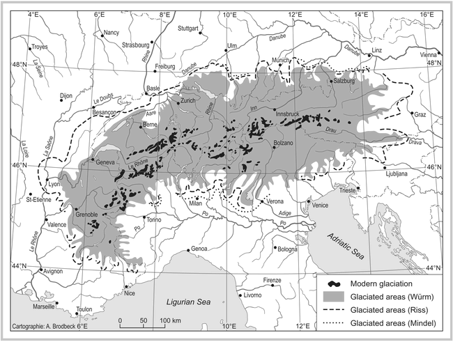
Pleistocene glaciation of the Alps, based on Glückert (1987) and Lister et al (1998). (Map by Andreas Brodbeck)
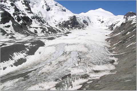
The Pasterze glacier & Johannisberg Mountain (3460m).
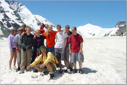
Us on the glacier
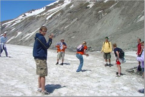
Snowballing in the snow
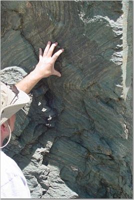 Checking out the
beautiful metamorphic rocks
Checking out the
beautiful metamorphic rocks
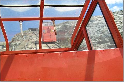
Some of us we will not name them took the cable car up, instead of walking.
After finishing our glacier tour we had to start toward the Netherlands.
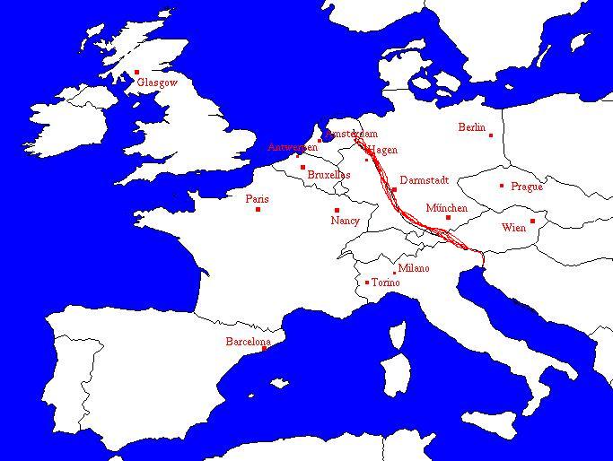
(perso.wanadoo.fr/ artnouveau/en/where.htm)
The red line on this map shows the distance. Really we had to cross half of Europe to get there. It took us ten hours of driving with a 100miles/hour average speed. Good thing there is not much of a speed limit in Germany. We got there two a.m. And this was our nicest hotel ever.
![]()
![]()